 |
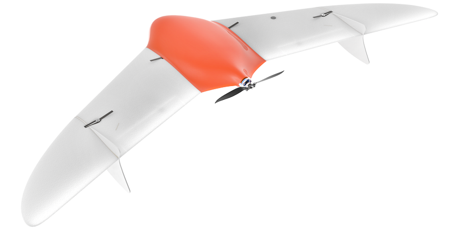
Unmanned aerial vehicle Geoscan 201
System designed for surveying of vast territories and linear-extended objects.
Part number:
Supplier:
Group of companies "Geoscan"Description
5 Reasons to choose Geoscan 201:
- Efficient. Geoscan 201 offers up to 3 hours flight time. This makes it capable to fly up to 100km away from the launch point and survey up to 16 km2 with 4 cm spatial resolution. System comes with 2 batteries ensuring continuous all day field operation.
- Rugged and compact. While developing Geoscan 201, we were focusing on the reliability and convenience of its operation. By applying special technologies in the frame structure and non-trivial solutions for compound wing design, we managed to achieve the desired rigidness of the frame and its compact placement upon transportation. The frame and the required equipment easily fit in a car trunk. Weight and dimensions of the cases comply with the checked baggage allowance.
- Flexible. Geoscan 201 is able to take up to 3 payloads simultaneously, capturing data in different spectral ranges.
- Easy to use. Geoscan 201 operates fully automatically. To launch it, you just need to place it on the catapult and push the button on the ground control station. Upon flight completion, -
Geoscan 201 will smoothly parachute down to the specified point.
- Safe. Our smart autopilot continuously monitors flight parameters: flight speed, altitude, attitude and battery level. In case of any abnormal situation, the UAV fly back to the start point or safely land in its current position. Controlling the flight from the ground station, you can always change or terminate the mission at the first demand.