
Vega Altamira Geospatial Support Program
Multiplatform: Debian, Ubuntu, AstraLinux, AltLinux
Part number:
Description
Key system features:
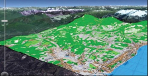
1. Means of geospatial visualization: visualization of geodata and operational information in two-dimensional and three-dimensional representation; simultaneous display of 5,000 dynamic (20 Hz) and 20,000 static objects; information output to means of collective display with a resolution of 4K and b with a resolution of 4K or more; flexible customization of display symbols; tools for quickly creating terrain models; video integration.
2. Geoportal: input, storage, search and viewing of all common geodata formats; formation of continuous formation of continuous geospatial coatings of the earth's surface; large and parallel processing of raster data; semantic search on raster data.
3. Computing and modeling system: support for the functioning of multi-agent architecture, which includes analytical and modeling agents; fast integration of analytical algorithms, models of physical processes, behavioral models due to the presence of built-in development tools; Used a large number of built-in algorithms and models.
4. Means of monitoring and control of operational facilities; quick integration of new types of facilities through the use of special interface modules; routing, delivery and archiving of telemetry, control teams, events, media data; built-in built-in library of graphical control and monitoring modules.